


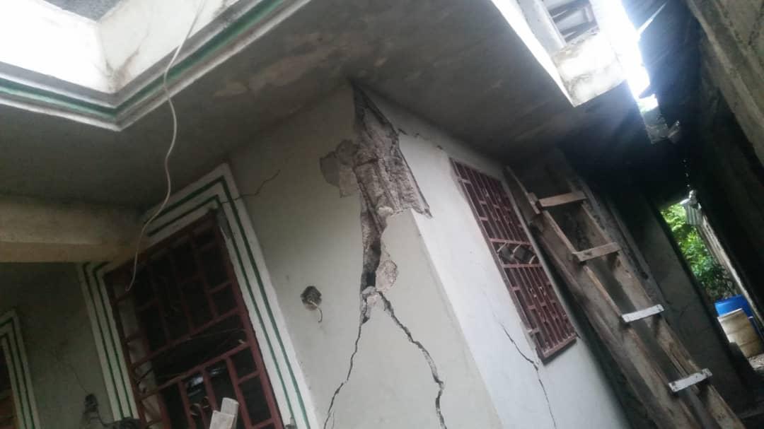
An earthquake measuring 5.9 on the Richter scale shook northern Haiti on Sat., Oct. 6, 2018, at 8:11 p.m. Haitian authorities say 17 people died and 427 were injured, but those figures are expected to rise. Authorities say 168 houses were destroyed, 2,280 damaged, and a few large structures, including a church, a school, and an auditorium, wholly or partially collapsed.
The epicenter of the quake was in the ocean, 12 miles north of Port-de-Paix, northwest Haiti’s largest city. Damage was also reported in the large town of Gros Morne, and at least one death occurred on La Tortue Island.

Some coastal areas, like St. Louis du Nord, were flooded by sea water after the quake, in what some called a “mini-tsunami.”
A magnitude 5.2 aftershock occurred at 4:00 p.m. on Sun., Oct. 7, some 10 miles north of Port-de-Paix. It was 11 times less powerful than the quake the day before.
Haiti’s north has registered several tremors and temblors in recent weeks. A 5.2 earthquake struck about 36 miles east of Fort Liberté on Sep. 23 at 1.46 a.m. and a 3.6 magnitude tremor struck 11 miles north of Cap Haïtien on Sep. 24 at 8:04 p.m..

“All this seismic activity could be a precursor to a major earthquake of magnitude 7 or 8,” said geological engineer Claude Prépetit, the director general of Haiti’s Office of Mines and Energy (BME). “We have to be ready for more powerful events.”
Prépetit said Haiti had recorded some 26 tremors between 2.9 and 4.6 from January to August 2018.
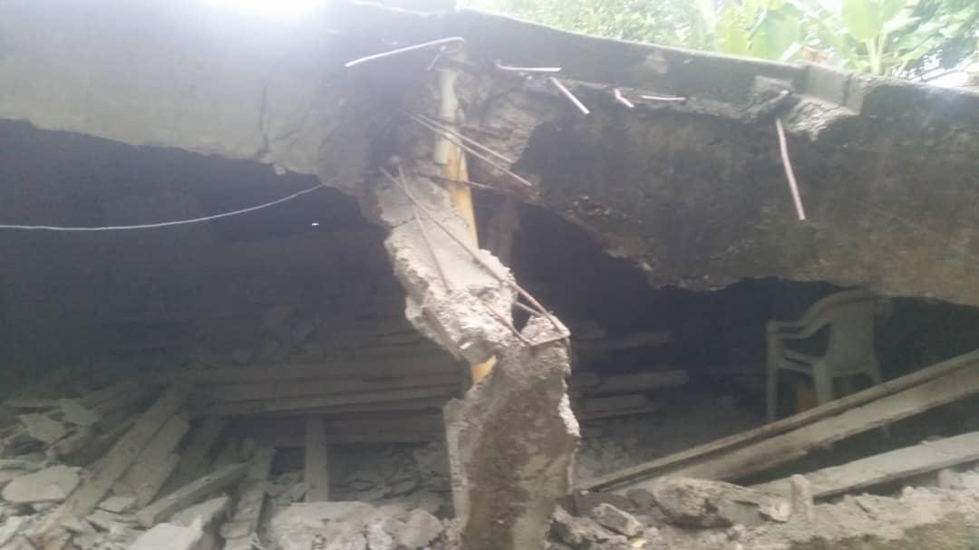
A 5.9 magnitude seism is about 45 times less powerful than the 7.0 earthquake that devastated the area around Haiti’s capital, Port-au-Prince, on Jan. 12, 2010. Nonetheless, it was still able to cause considerable damage due to the poor construction of many homes and buildings in Haiti. In Gros Morne, a large auditorium completely collapsed and St. Gabriel’s primary school crumpled. In Plaisance, the front of a large Roman Catholic church fell down, and in Port-de-Paix, the main police station was badly damaged.
The Septentrional Fault Zone runs the length of Haiti’s northern coast while the Enriquillo-Plantain Garden Fault Zone runs down the middle of Haiti’s southern peninsula.
On May 7, 1842, an estimated 8.1 magnitude struck near Cap Haïtien, leveling the city and triggering a tsunami. Some 5,000 were killed by the earthquake and 300 by the tsunami.


